The Char Dham Yatra is a journey of sublime contrasts. You begin by trekking to the raw, rugged heights of Shiva’s Kedarnath and conclude by descending toward the serene, contemplative seat of Vishnu’s Badrinath. The pivotal transition between these two divine realms is the road journey from Kedarnath’s base (Sonprayag/Gaurikund) to the ancient, strategic town of Joshimath.
This guide is designed to navigate you through Kedarnath To Joshimath this essential, yet often complex, leg of your Himalayan pilgrimage. It is a route that demands patience, careful planning, and an appreciation for the breathtaking landscapes that unfold along the Alaknanda and Mandakini river valleys.
Descending from the Abode of Shiva
Before your road journey can even begin, you must complete the final stretch from the Kedarnath Temple itself.
The Kedarnath Trek Back to the Road Head
Your journey starts at the temple (11,755 ft) and ends at the official road head, Gaurikund, or the primary base camp, Sonprayag.
- Kedarnath Temple to Gaurikund: The trek is approximately 16-18 km of continuous descent. It typically takes pilgrims 4 to 6 hours to complete.
- Logistics:
- Pony/Palki: If you used these services for the ascent, you must secure them again for the descent.
- Helicopter: If you flew to Kedarnath, the helipad (usually Phata, Guptkashi, or Sirsi) will be your starting point for the road journey. The logistics here are simpler, bypassing the need for the trek.
- Gaurikund to Sonprayag: Gaurikund is strictly for dropping off/picking up trekkers. All parking and major commercial activities are based at Sonprayag, located about 5-6 km downhill from Gaurikund. Shared taxis (generally local Boleros or Taxis) run frequently between these two points, costing a nominal fare.
Crucial Fresh Insight: Always aim to complete your descent from the temple and reach Sonprayag/Guptkashi before noon. This allows ample time to secure transport for the next long segment and adhere to the Himalayan driving restrictions (no driving after dark).
The Core Road Journey (Sonprayag/Guptkashi to Joshimath)
This is the main leg of the journey, covering the distance that weaves through the heart of the Garhwal Himalayas.
The Route and Key Junctions
The direct road distance from the Kedarnath region’s main hub (like Guptkashi or Rudraprayag) to Joshimath is approximately 185 to 200 kilometers, depending on the exact starting point.
The Major Route:
- Sonprayag/Guptkashi (Mandakini River Valley)
- Ukhimath (The winter seat of Kedarnath)
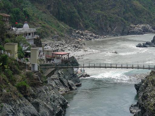
- Rudraprayag (The confluence of the Mandakini and Alaknanda rivers)
- Karnaprayag (The confluence of the Pindar and Alaknanda rivers)
- Nandaprayag (The confluence of the Nandakini and Alaknanda rivers)
- Chamoli/Pipalkoti (Major towns for refueling/stoppages)
- Joshimath (The base for Badrinath)
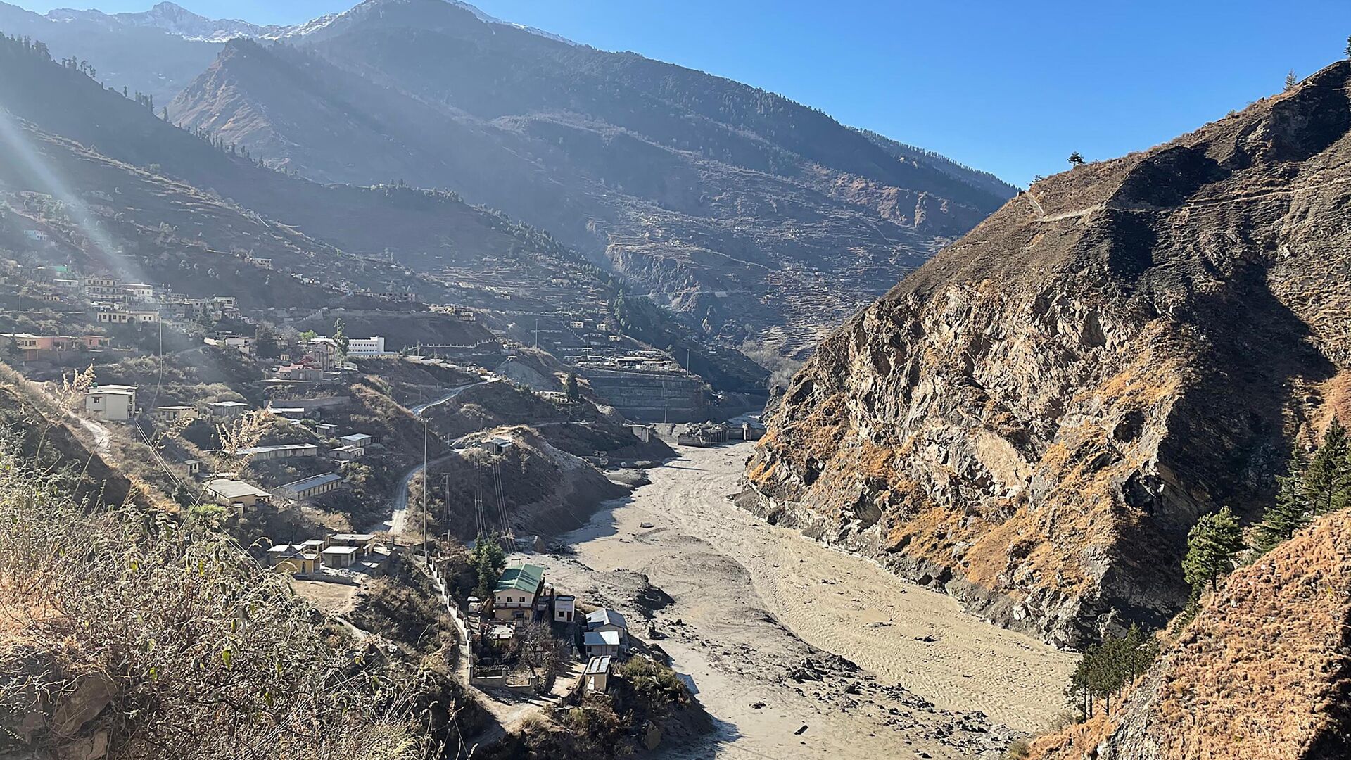
This entire route follows the Alaknanda River (after Rudraprayag) along the National Highway (NH 7, formerly NH 58), which is part of the ongoing Char Dham All Weather Road project.
Modes of Transport: Choosing Your Ride
The choice of transport dictates your comfort, cost, and travel time.
| Transport Mode | Pros | Cons | Estimated Time & Cost (Approx.) |
| Private Taxi/Cab | Fastest, most comfortable, door-to-door service, flexible stops. | Most expensive option. | 5.5 to 7 Hours (Driving time). Cost: ₹7,000 – ₹10,000 (one-way, vehicle basis). |
| Shared Taxi (Jeep/Max) | Highly economical, available at all major hubs (Guptkashi, Rudraprayag). | Crowded, fixed departure times, minimal luggage space. | 7 to 9 Hours (Including pickups/drops). Cost: ₹700 – ₹1,200 per seat. |
| Local Bus (Uttarakhand Parivahan) | Most affordable transport, reliable for major sections. | Fixed route, slow, service is less frequent than shared taxis, often requires changing buses at Rudraprayag. | 8 to 10+ Hours (May involve layovers). Cost: ₹400 – ₹700 per seat. |
Practical Travel Tip: If you are staying near Guptkashi after your trek, you will find it easier to hire a private or shared taxi there than at Sonprayag. For bus travel, you will likely need to catch an early morning service from Rudraprayag.
Timing the Journey: The Himalayan Clock
The journey is governed by two critical factors: the time you start and the road conditions.
- Best Time to Start: Early morning (between 5:00 AM and 6:00 AM) is highly recommended. Not only does this guarantee you reach Joshimath before sunset (critical for safety), but it also helps you secure a spot on a shared vehicle.
- The Travel Time Reality: While GPS might quote a 5.5-hour driving time, the reality on the mountain roads—including essential stops for food, road work, possible landslides (during monsoon), and the winding terrain—pushes the total travel time to a minimum of 7 to 8 hours. Plan for this buffer.
- Security Gates: During the pilgrimage season, there are checkpoints where vehicles are registered. This contributes to the overall travel duration.
The Spiritual and Scenic Wonders En Route
The journey from Kedarnath to Joshimath is not just about logistics; it’s a spiritual corridor that connects the power of Shiva to the tranquility of Vishnu.
The Panch Prayag (Five Confluences)
The route allows you to witness two of the most famous Panch Prayag (Five Sacred Confluences) of the Alaknanda River:
- Rudraprayag: The first major confluence where the fierce Mandakini River (from Kedarnath) merges with the mighty Alaknanda River. This confluence is dedicated to Lord Shiva (Rudra). Stopping here for a moment to witness the distinct colors of the rivers meeting is highly recommended.
- Karnaprayag: Further along, the Pindar River merges with the Alaknanda. Named after the Mahabharata hero Karna, it holds immense spiritual significance.
The shift in energy from the roaring Mandakini near Guptkashi to the wider, calmer Alaknanda near Joshimath mirrors the change from the arduous trek to the anticipated peace of Badrinath.

Scenic Highlights and Pit Stops
- Ukhimath: A significant religious stop, Ukhimath is the winter seat of Kedarnath (Omkareshwar Temple). If time permits, a quick visit here offers insight into the winter rituals of the Kedar Valley.
- Pipalkoti: A large, well-established town that serves as an excellent lunch and refreshment stop. It offers better restaurants and more amenities than the smaller villages.
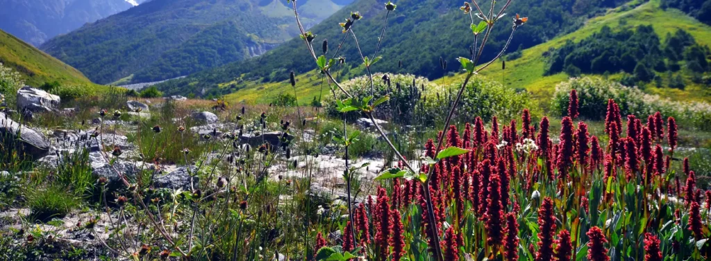
- Chamoli: Known for its natural beauty and a significant administrative center. The drive around here is particularly picturesque, with terraced fields and thick pine forests.
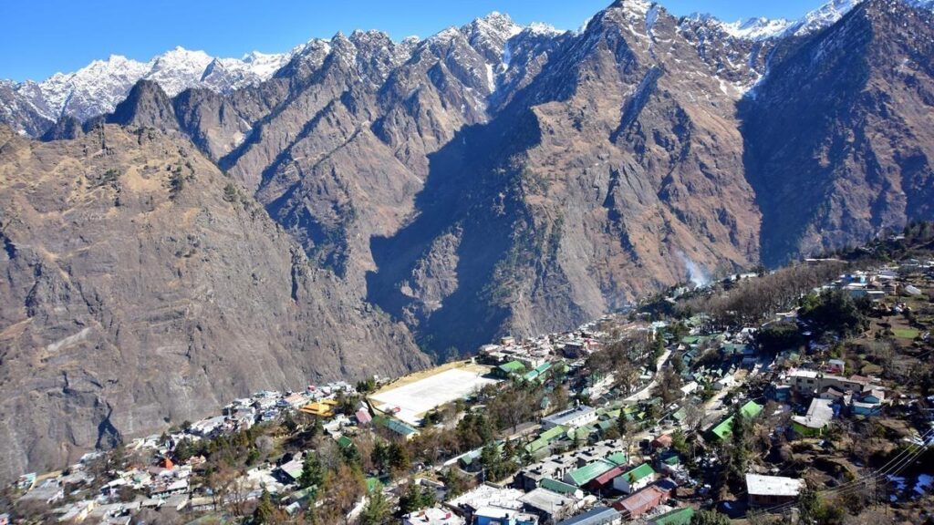
Arrival and Strategy in Joshimath
Joshimath (Jyotirmath), situated at approximately 6,150 ft, is not merely a stopover; it is the strategic hub for the entire upper Garhwal region.
Why Joshimath is Critical
- Winter Seat of Badrinath: It houses the Narsingh Temple, where the idol of Lord Badrinath resides during the six months the main Badrinath Temple is closed.
- Gateway to Badrinath: Badrinath is only about 45 kilometers away from Joshimath (approx. 1.5 to 2 hours drive). It is the most convenient and popular overnight halt before visiting Badrinath.
- Trekking & Adventure Hub: Joshimath is the starting point for the famous Auli Ropeway, the base for the Valley of Flowers and Hemkund Sahib treks (via Govindghat), and the gateway to the Niti Valley.
Accommodation and Safety
- Accommodation: Joshimath offers a wide range of stays, from basic dharamshalas and budget guesthouses to comfortable hotels catering to both pilgrims and Auli tourists. Booking ahead during peak season (May-June) is essential.
- Altitude Adjustment: While lower than Kedarnath, it is still advisable to hydrate adequately upon arrival.
Updated Concern (Freshness Alert): Joshimath has faced significant geological instability in recent years (land subsidence). While travel to Badrinath continues, travelers should follow the latest local advisories regarding accommodations and movement within the town. Reputable hotels and government-approved sites are generally deemed safe for pilgrim stays.
Frequently Asked Questions (FAQ’s)
What is the distance from Kedarnath to Joshimath?
The distance is approximately 210–230 km by road, depending on the route taken. It usually takes around 8–10 hours due to hilly terrain.
What is the best way to travel from Kedarnath to Joshimath?
The most common way is by road, either via private cabs, taxis, or shared vehicles. Since Kedarnath itself is only accessible by trek or helicopter, the journey begins after returning to Gaurikund.
Are there direct buses from Kedarnath to Joshimath?
There are no direct buses. Travelers usually take a cab or taxi from Gaurikund to Joshimath, or a combination of local buses and shared taxis.
Is the route safe for solo travelers?
Yes, the route is generally safe, but the roads are hilly and narrow. It’s recommended to travel during daylight hours and check weather conditions beforehand, especially during the monsoon season.
What are the road conditions like?
The roads are winding mountain roads with some steep stretches. Landslides can occur during the monsoon. Roads are mostly paved, but careful driving is required.
Can I do this journey in a single day?
Technically yes, but it can be long and tiring. Many travelers prefer to break the journey with a stop at Rudraprayag or other towns en route.
Are there fuel stations and amenities on the way?
Fuel stations are limited along the route, so it’s advisable to fill up in larger towns like Rudraprayag. Food and rest stops are available in small towns along the way.
What is the best time to travel from Kedarnath to Joshimath?
The best time is May to October, avoiding heavy rains and winter snowfall, which can make roads risky or blocked.
Are taxis or private cars available for hire?
Yes, taxis and private cars can be hired from Gaurikund, Rudraprayag, or Kedarnath base camps. Advance booking is recommended in peak season.
Can I do this route via helicopter?
There are helicopter services to Kedarnath from places like Phata or Guptkashi, but no regular helicopter service connects Kedarnath directly to Joshimath.