Kedarnath Tungnath Tour Package: In this guide, you will explore the sacred route and the actual Kedarnath to Tungnath distance, a journey that connects two of the most significant Panch Kedar temples. Covering approximately 80–90 km by road, this path takes you from the steep Mandakini valley to the high-altitude meadows of Chopta.
You’ll learn that the transition involves more than just a drive; it requires descending from the heights of Kedar, navigating the winding mountain roads through Ukhimath, and finally tackling the trek to the world’s highest Shiva temple. We break down the maps, travel times, and trekking essentials to help you bridge the gap between these two spiritual pillars.
Tungnath to Kedarnath Distance
While Tungnath and Kedarnath feel worlds apart in their energy, they are geographically closer than you might think, though separated by high ridges and deep river valleys.
The total distance connecting the two base camps Chopta (for Tungnath) and Gaurikund/Sonprayag (for Kedarnath) is approximately 80 to 90 kilometers by road.
Crucially, there is no direct trekking route linking the two that is commonly used by pilgrims. The path is a road journey that takes you from the Mandakini river valley (Kedarnath’s side) over the mountains and down into the Alaknanda river system (the wider region for Tungnath), involving a beautiful, multi-hour drive.
The Road Journey
Imagine you have just finished the tranquil, sub-alpine climb to Tungnath (a modest 3.5 km trek from Chopta), and you’ve stood on the summit of Chandrashila, witnessing the 360-degree sweep of the giants like Chaukhamba and Nanda Devi. The next morning, the journey to the base of Kedarnath begins:
- Chopta to Ukhimath (approx. 30 km): This is the first gentle descent through rich oak and rhododendron forests. Ukhimath is the winter seat of the Kedarnath and Madhyamaheshwar deities (Omkareshwar Temple). It is a vital junction and often the first place to find more robust lodging or transport.
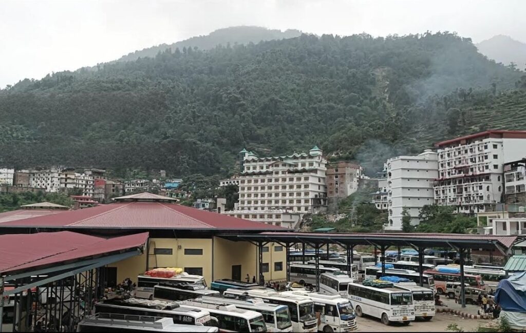
- Ukhimath to Guptkashi (approx. 45 km): The road continues, joining the main pilgrimage route. Guptkashi is a major town with good infrastructure and is often the main halting point for the entire Kedarnath Yatra. The presence of the ancient Vishwanath Temple here offers a sense of continuity.
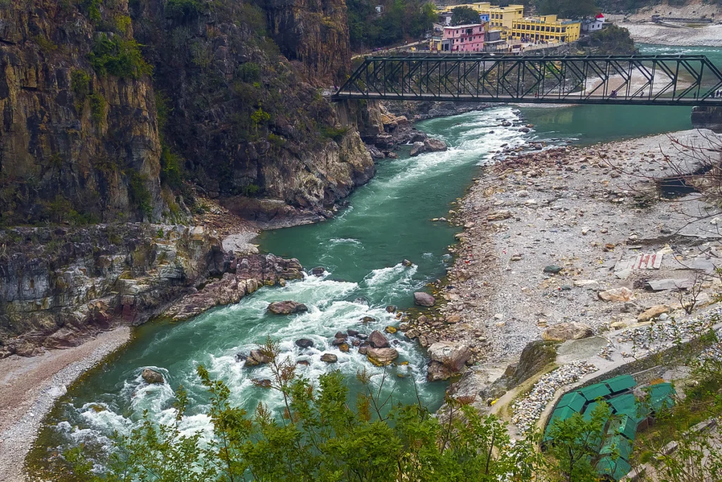
- Guptkashi to Sonprayag (approx. 30 km): This is the final stretch along the banks of the Mandakini River. The landscape here is dramatic and the pilgrimage energy palpable. Sonprayag is where all private vehicles must stop.
- Sonprayag to Gaurikund (approx. 5 km): The last leg of the motorable road, typically covered by local shared jeeps, brings you to Gaurikund the actual starting point of the Kedarnath foot pilgrimage.
Total Travel Time: The driving time alone for this entire stretch is typically 4 to 6 hours, depending heavily on road conditions and traffic congestion around the major towns. It is a full day of travel if you factor in the prior trekking efforts, acclimatization, and transfers.
Tungnath and the Chopta Sanctuary
The Tungnath region is often the perfect spiritual palate cleanser before the demanding journey to Kedarnath. Its atmosphere is one of profound, yet gentle, beauty.
Chopta: The Mini-Switzerland Prelude
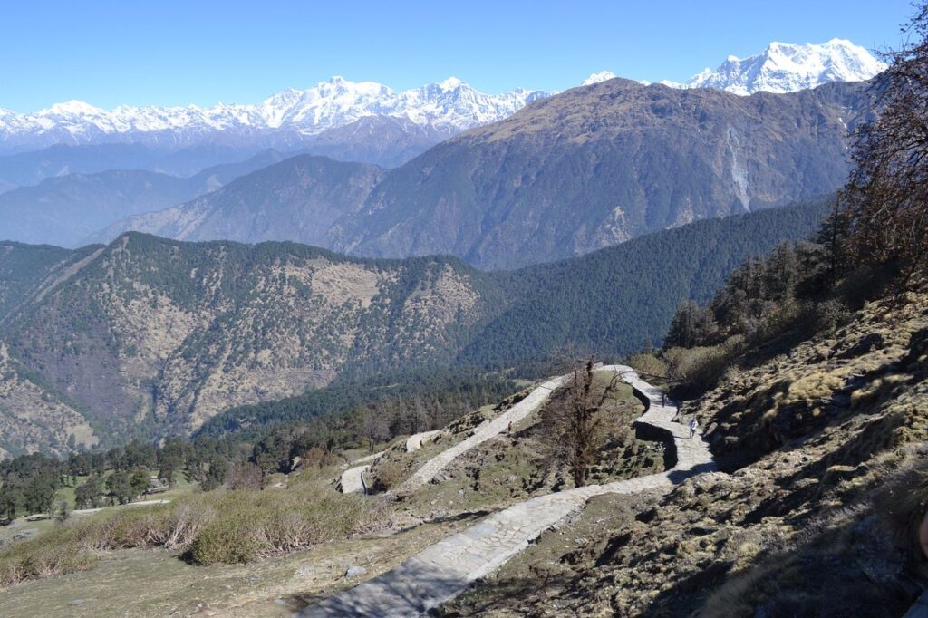
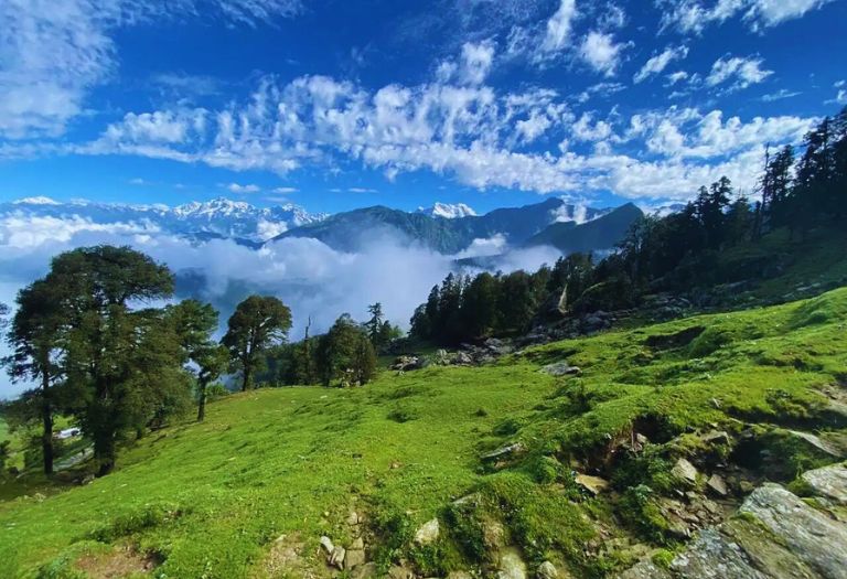
- The Vibe: Known lovingly as the “Mini Switzerland of India,” Chopta itself is not a town but a cluster of sprawling, emerald-green meadows framed by deep deodar and pine forests. Its relative lack of commercial development preserves a pristine solitude that is hard to find elsewhere on the main pilgrimage routes.
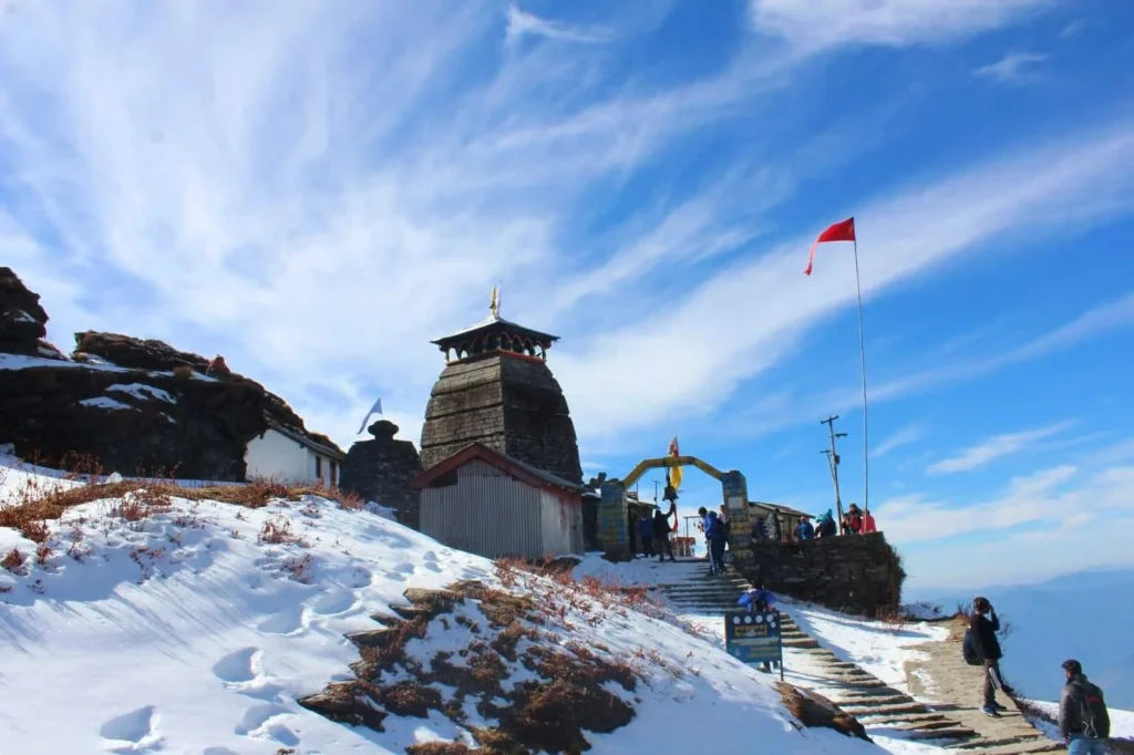
- The Climb: The trek to the Tungnath temple is a relatively easy 3.5-kilometer, stone-paved climb. It is the perfect acclimatization trek, accessible to almost all age groups, offering a rewarding blend of spiritual devotion and natural immersion.
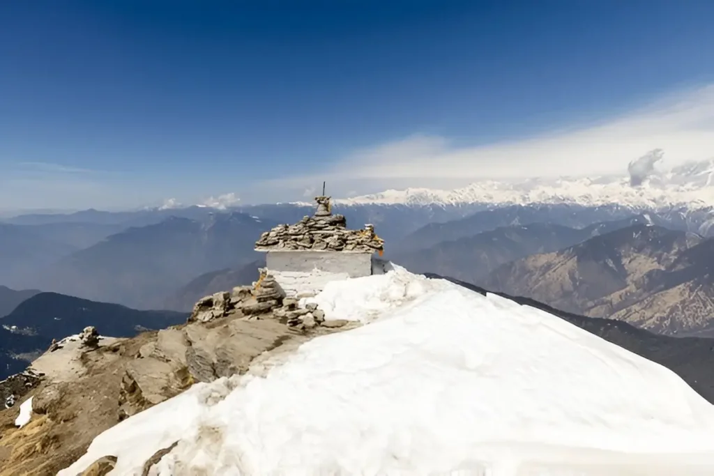
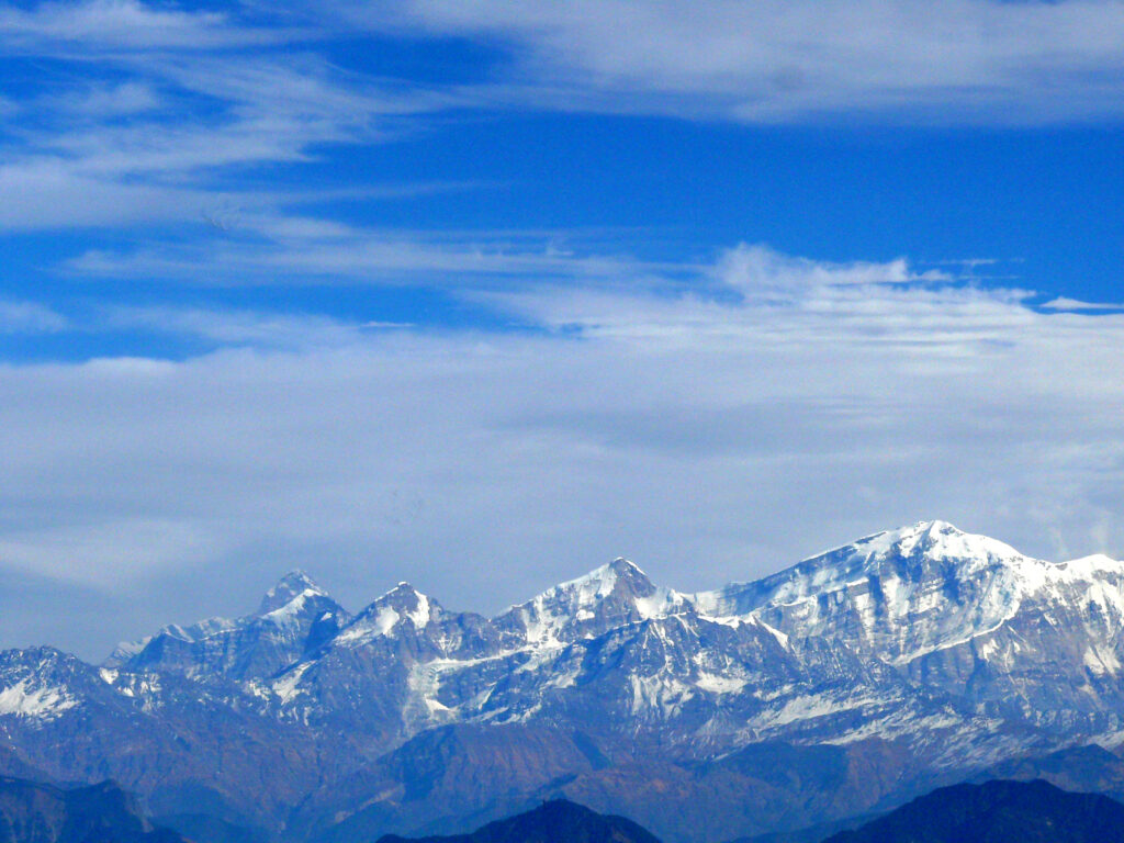
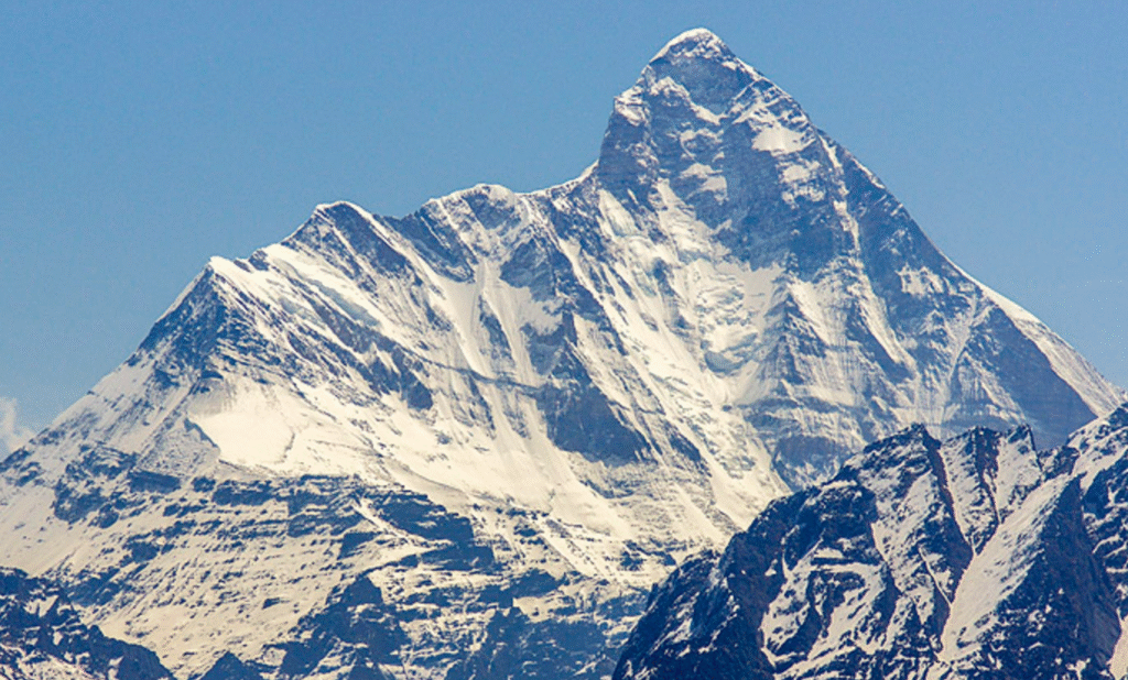
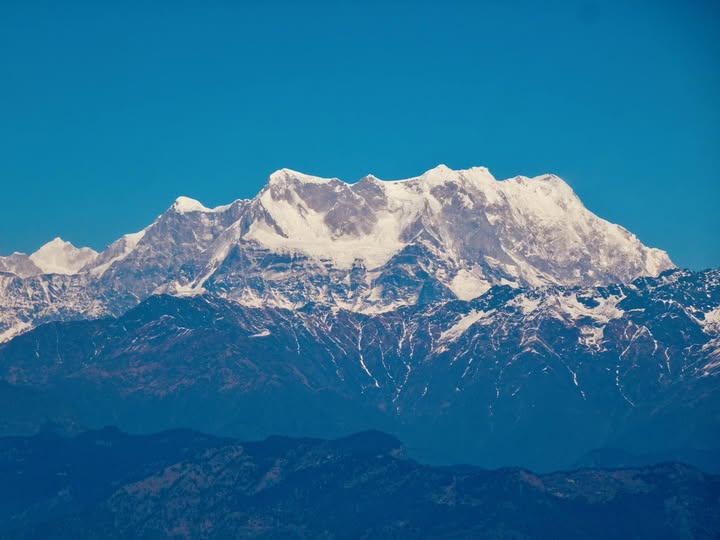
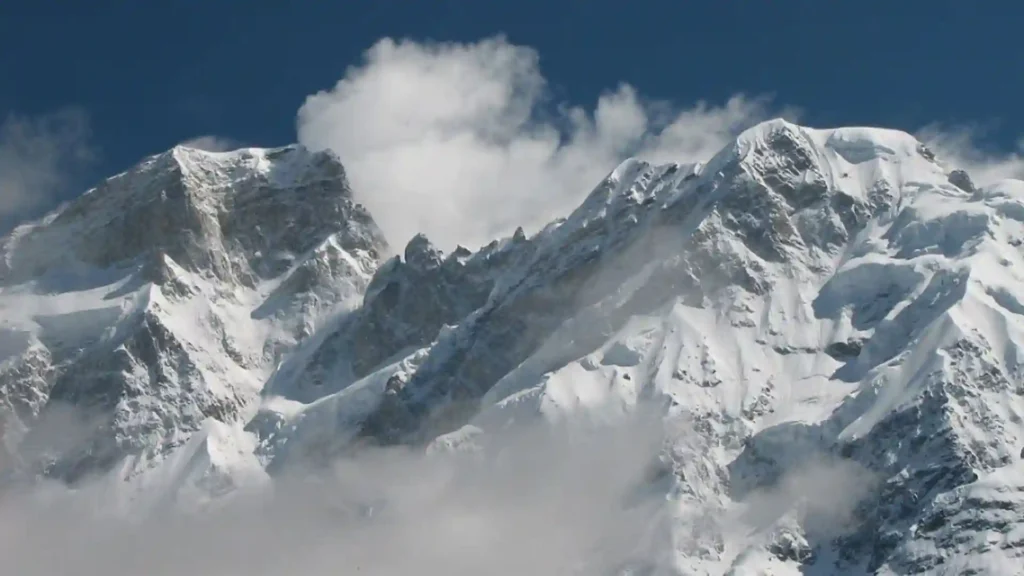
- The Summit: The optional final 1.5-kilometer push to the Chandrashila Peak (13,000 ft) is a mandatory experience. Standing here at sunrise, the peaks of Trishul, Nanda Devi, and Chaukhamba ignite with a golden glow. It’s an act of worship purely to the view a perfect moment to reflect and ready the spirit for the challenges ahead.
The simplicity of Chopta staying in basic tents or homestays, walking through the silent forests, and drinking tea while watching the distant Kedar range serves as the necessary grounding before you enter the raw, high-stakes zone of Kedarnath.
The Transition and The Mandakini Valley
The journey down from Chopta to the Mandakini River valley is where the transition in energy truly happens.
The landscape shifts from the gentle, rolling bugyals (alpine meadows) to the steep, often rugged contours of the Kedar region. You leave the rhododendron belt and enter a zone defined by the power of the Mandakini River, which famously demonstrated its devastating might during the 2013 floods.
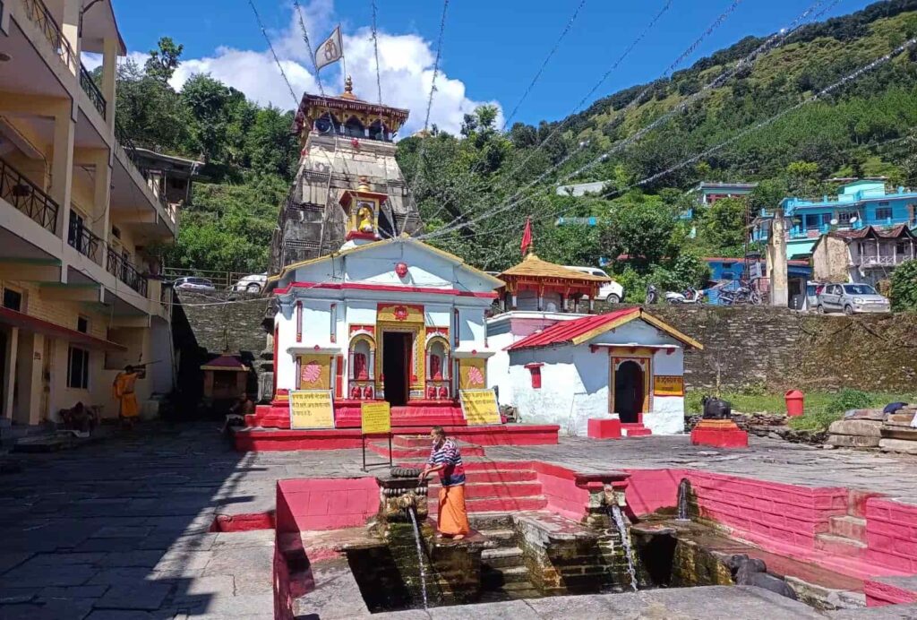
- Guptkashi: Serving as the key hub, this town holds its own spiritual weight. It is believed that Lord Shiva concealed himself here from the Pandavas before reappearing at the five Kedar locations. Spending a night here is highly recommended for resting and sourcing supplies.
- Triyuginarayan Temple: A slight detour from the main route leads to this ancient, beautiful temple. According to Hindu mythology, this is the very spot where Lord Shiva and Goddess Parvati were married, with Lord Vishnu acting as the witness. It’s an essential, breathtaking stop that adds context to the pilgrimage, connecting the divine narrative directly to the landscape you are traversing.
Kedarnath – The Monumental Ascent
Reaching Sonprayag and Gaurikund marks the end of the road journey and the beginning of the great, defining pilgrimage trek to Kedarnath. The energy here is electric a mix of awe, anticipation, and the relentless flow of devotion.
The Kedarnath Trek: A Test of Will
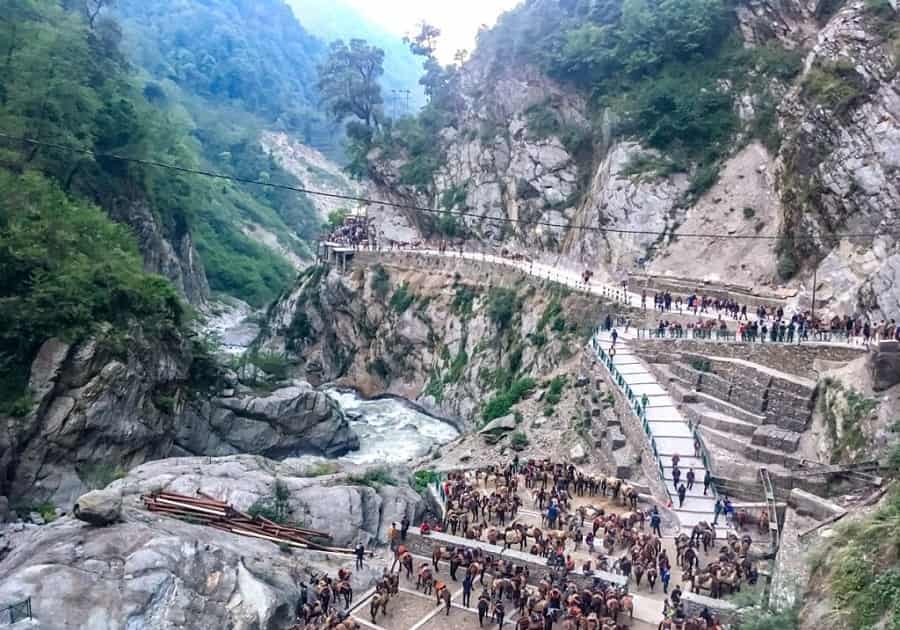
- The Distance and Terrain: The Kedarnath trek from Gaurikund is approximately 16 to 18 kilometers (depending on the exact route taken post-2013). This is not the gentle, winding path of Tungnath. It is a challenging, relentless ascent that tests the body and the mind. It’s a route defined by its altitude, its continuous upward gradient, and the constant awareness of the monumental landscape carved by ancient glaciers and geological forces.
- The Ascent Vibe: The path is well-maintained and heavily trafficked during the season. It’s a collective act of faith, shared by thousands of pilgrims walking, on ponies, or carried in dolis (palanquins). You are surrounded by the raw, unbridled power of the mountains. The peaks loom closer, the air thins, and every kilometer walked is a deliberate offering.
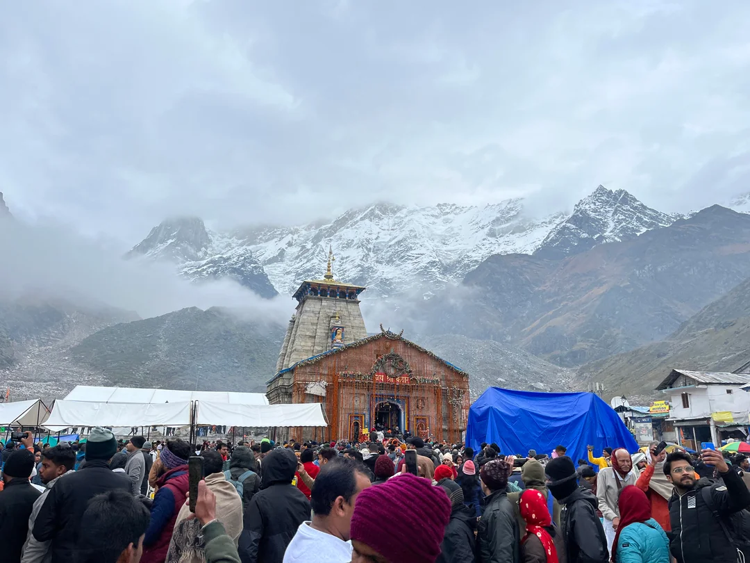
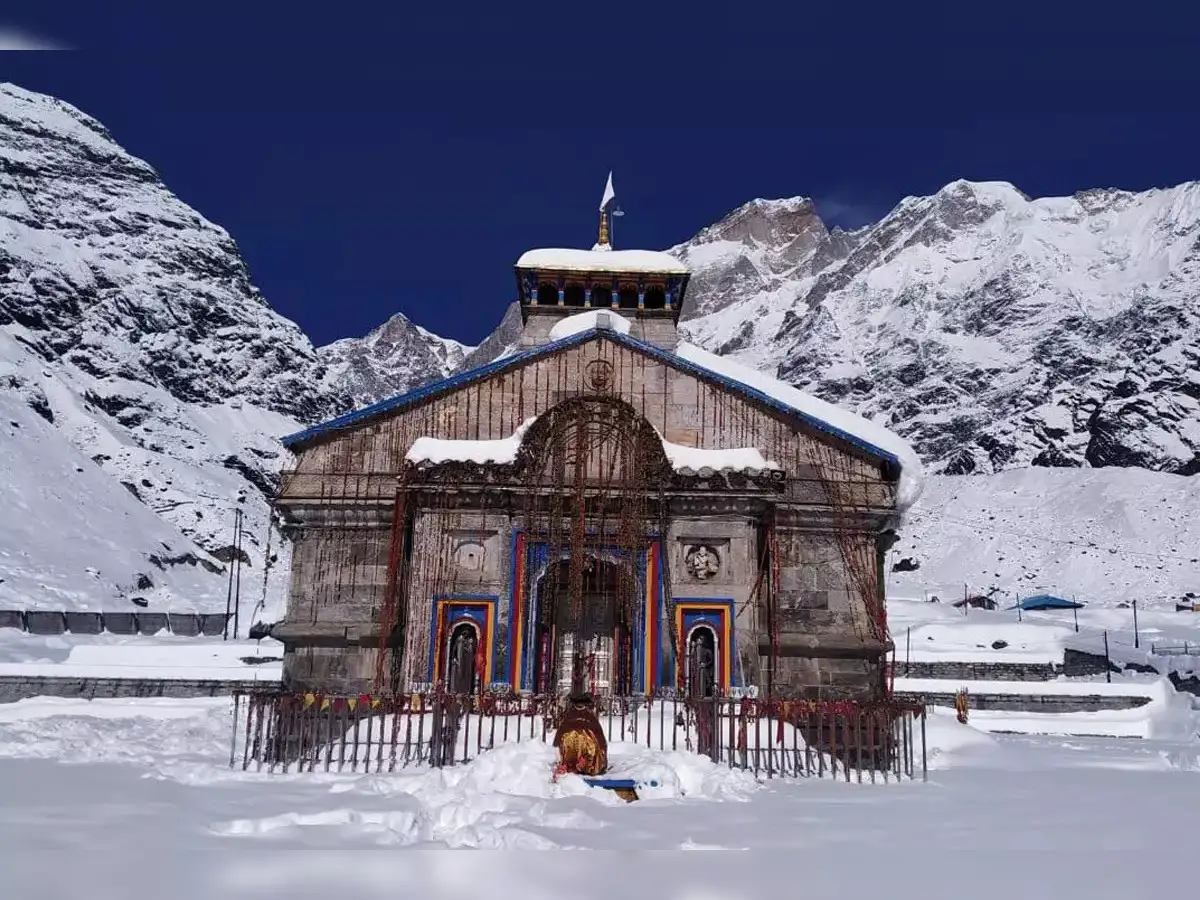
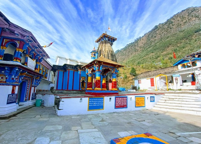
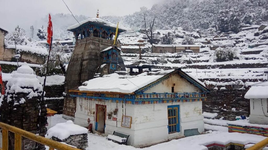
- The Final View: The reward is the temple itself a magnificent, millennia-old stone structure, one of the twelve Jyotirlingas, standing in stark, profound solitude against the backdrop of the massive Kedarnath range. The silence and the sheer scale of the landscape surrounding the temple are a spiritual force unto themselves.
The Complete Loop:
To visit both Tungnath and Kedarnath in a single journey is to complete a powerful microcosm of Himalayan pilgrimage. You experience:
- Diversity of Terrain: From the smooth, high meadows of Chopta to the rocky, glacial moraines surrounding Kedarnath.
- Balance of Effort: The accessible joy of the Tungnath climb balances the intense commitment required for the Kedarnath ascent.
- Narrative Continuity: You connect the ‘arm’ of Shiva (Tungnath) to the ‘hump’ of Shiva (Kedarnath), fulfilling a core part of the Panch Kedar story.
This journey is a reminder that the true destination is not just the temple, but the transformation that occurs within you on the winding road and the steep, sacred trail. It’s about leaving the commercial world behind and entering a space where every step is a prayer.
Frequently Asked Questions (FAQ’s)
What is the distance between Tungnath and Kedarnath?
The distance between Tungnath and Kedarnath is around 80–92 kilometers by trekking routes, depending on the path taken.
Can I travel directly from Tungnath to Kedarnath by road?
No, there’s no direct road between Tungnath and Kedarnath. You must first trek down to Chopta and then travel by road to Sonprayag or Gaurikund, the base for the Kedarnath trek.
How long does it take to travel from Tungnath to Kedarnath?
It usually takes 7–9 hours including trekking and driving, depending on the route, weather, and breaks.
What is the best route from Tungnath to Kedarnath?
The most common route is Tungnath → Chopta → Ukhimath → Guptkashi → Sonprayag → Gaurikund → Kedarnath.
Is the trek from Tungnath to Kedarnath difficult?
Moderate to difficult. The trails involve steep climbs, high altitude, and variable weather conditions, so some trekking experience is recommended.
What is the best time to travel from Tungnath to Kedarnath?
The best time is May to October, except during the monsoon months (July–August) when landslides and heavy rain are common.
Are there accommodations between Tungnath and Kedarnath?
Yes, you’ll find guesthouses, lodges, and camps at Chopta, Ukhimath, Guptkashi, and Sonprayag. Kedarnath also has basic lodging options.
Can I visit both Tungnath and Kedarnath in one day?
It’s possible but quite tiring. Starting early morning from Tungnath, you may reach Kedarnath by evening if the conditions are good.
How can I reach Tungnath before going to Kedarnath?
You can reach Tungnath via Chopta, which is connected by road to Rishikesh, Haridwar, and Dehradun. From Chopta, it’s a 3.5 km trek to Tungnath.
What should I carry while traveling from Tungnath to Kedarnath?
Carry warm clothes, trekking shoes, rain gear, personal medicines, snacks, and a power bank. The weather can change quickly in the Himalayas.